
概述 Overview
建筑物、道路等工程总是在起伏不平的地面上修建的,有时无法用三面投影图表达清楚,所以选用标高投影法来绘制地形图。
Buildings, roads and other projects are always built on the undulating ground, and sometimes it is impossible to express clearly with three-side projection map, so elevation projection method is selected to draw.
标高投影法采用水平投影并标注特征点、线、面的高度数值来表达空间形体,它是一种标注高度数值的单面正投影。
Elevation projection method USES horizontal projection and mark the height value of feature points, lines and planes to express the spatial body.
用一组等间隔的水平面截割地形曲面,得到一组水平截交线,称为等高线。将它们投射到水平投影面(基准面)上,并标出各自的标高,即得标高投影图,也称地形图。见图10-1。
A set of horizontal intersecting lines, called contour lines, are obtained by cutting the terrain surface with a set of equal-spaced horizontal planes. Project them onto a horizontal projection plane (datum plane) and mark their respective elevations.
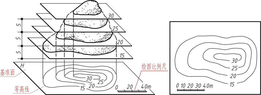
图10-1 地形图

